
VIDEO WATCH: In this brief video, Christian Johnson, senior development engineer with Pacific Northwest National Laboratory, guides viewers through EM’s new Tracking Restoration and Closure web-based application, scheduled for release to the public in October.
WASHINGTON, D.C. – EM has developed a series of innovative initiatives to support improved groundwater monitoring and remediation across the DOE complex, including a new publicly available web-based application.
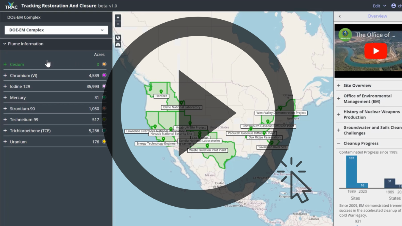
“The new Tracking Restoration and Closure (TRAC) application uses a combination of infographic and story map tools to communicate information on progress towards site closure,” said Grover Chamberlain, program manager. “The system presents what is often complex information in a visual way, making it more digestible for those who may not be groundwater experts, while still providing all the critical technical information in one place.”
As part of National Water Quality Month, EM announced other groundwater-related initiatives that will work in concert with TRAC, including the Advanced Long-Term Environmental Monitoring Systems (ALTEMIS) and a new soil and groundwater remediation strategy.
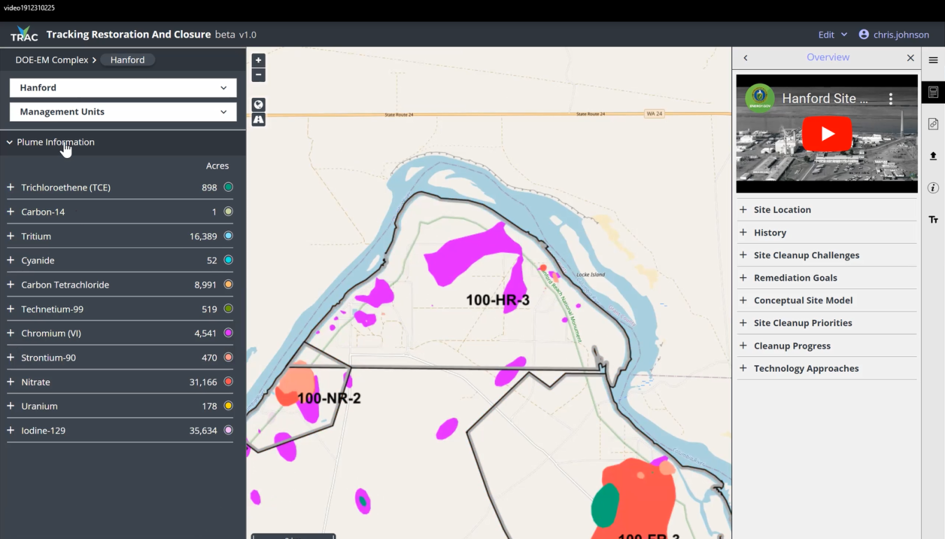
EM’s new Tracking Restoration and Closure application, shown here, displays a chromium groundwater plume at the Hanford Site, with a visual depiction of the plume size shown in purple. Metrics on the plume can be seen at left. Users can select date ranges and view progress in the remediation of groundwater plumes across the DOE complex.
Scheduled for release in October, TRAC will be available on Pacific Northwest National Laboratory’s (PNNL) webpage, allowing users to track remediation progress year to year and stay up to date on regulatory status, remediation goals, contaminated groundwater plume status and more.
The TRAC application features a map of all EM sites with metrics on high-priority contaminates of concern. Users can zoom in to specific sites to view geospatial footprints of groundwater plumes and the remediation strategies for them, and get updates and information on progress toward site closure.
Providing updated summaries of groundwater data and cleanup progress across sites, TRAC improves collaboration among users to maximize remediation efforts.
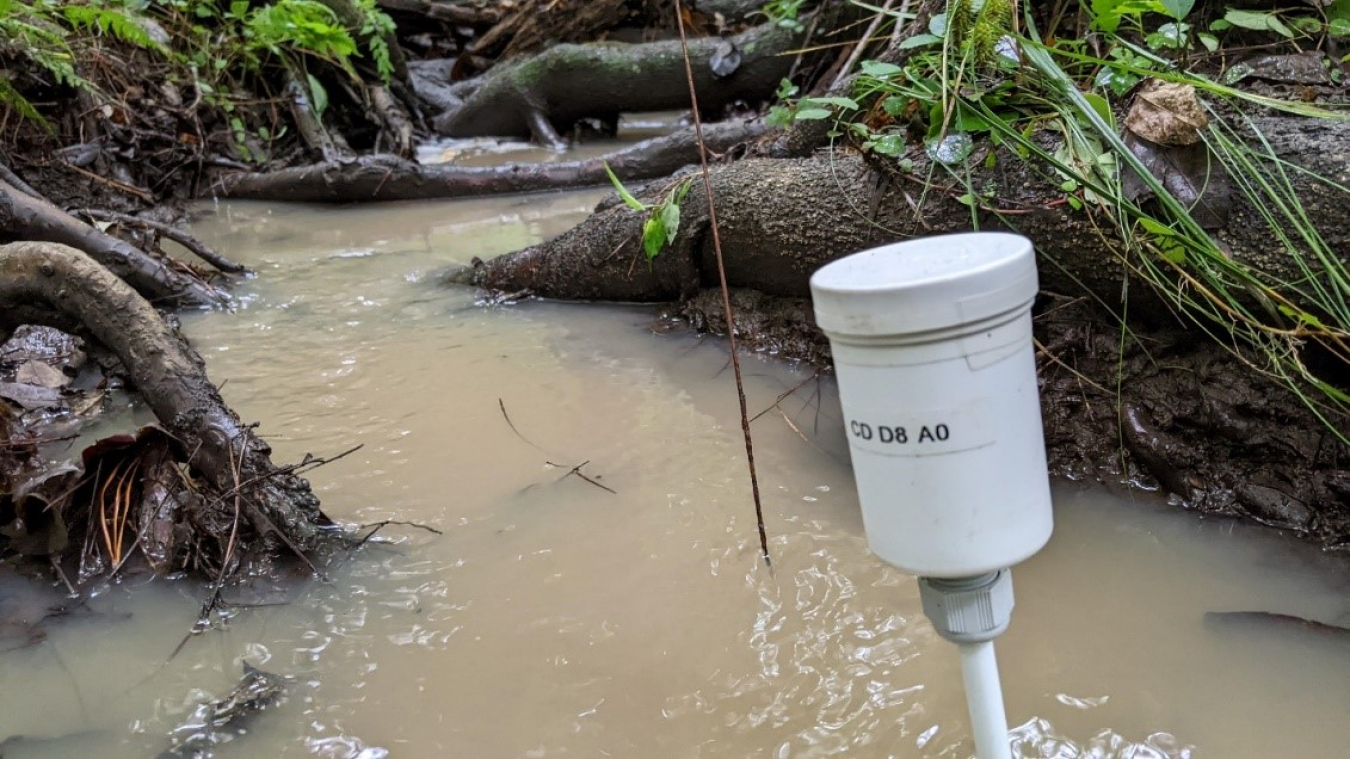
Savannah River National Laboratory, in collaboration with Lawrence Berkeley National Laboratory and the Savannah River Site (SRS), installed temperature probes at 97 locations within the F-Area wetlands at SRS as part of the Advanced Long-Term Environmental Monitoring Systems project to support development and implementation of a long-term monitoring strategy for contaminated sites.
“With TRAC, sites and the headquarters office can all be looking at the same information from anywhere in the world, improving our ability to develop solutions for shared issues, come together on lessons learned and discuss strategies for expediting site closures,” said Rob Seifert, director of EM’s Subsurface Closure Office.
TRAC also enables effective communication with regulators, stakeholders and partners, enhancing EM’s ability to identify efficiencies for remediation.
The scheduled October release of TRAC includes data for Hanford, Idaho National Laboratory and Savannah River sites. The application is set to be updated in the near future with information on all sites, giving users the ability to track groundwater status for the entire EM complex.
The new soil and groundwater remediation strategy conducted in partnership with PNNL and the Savannah River National Laboratory (SRNL) will create a consistent framework for how EM tracks cleanup progress, according to Chamberlain.
“When complete, the new closure strategy will provide an updated look at groundwater issues across the complex and what obstacles are preventing or slowing site closure,” he said. “That information can be cross-referenced with the other monitoring tools such as TRAC and ALTEMIS to identify the best solutions for overcoming those obstacles.”
ALTEMIS is a collaboration between PNNL, SRNL, Lawrence Berkeley National Laboratory, Massachusetts Institute of Technology and Florida International University.
Currently being tested as a pilot project at the Savannah River Site, ALTEMIS will support continuous monitoring of groundwater plumes and wells for decades while EM works toward closure of groundwater sites.
Researchers are installing low-cost sensors to autonomously monitor changes in groundwater plume behaviors, lowering costs and providing additional assurance to the public that groundwater remains safe in these areas after EM’s cleanup work is completed.
ALTEMIS will also aid in the eventual transfer of sites to the DOE Office of Legacy Management for long-term stewardship oversight.
Check out EM’s Facebook and Twitter pages for more information.
To receive the latest news and updates about the Office of Environmental Management, submit your e-mail address.